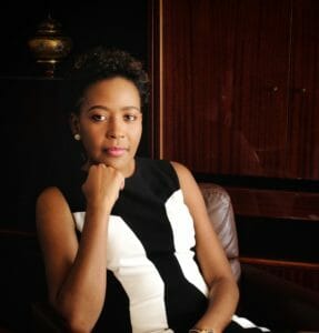
Be authentic. Be yourself. Make sure your superpower is your persistence because you are going to need it,
Valrie Grant — Founder and MD, GeoTechVision, Jamaica
2020 WE Empower Awardee, Latin America/Caribbean
As the first black woman-owned spatial solutions business in the Caribbean, Grant understands the intersectional challenges that women face entering a male-dominated industry. Despite these hurdles, Grant has fostered a geospatial business that impacts systemic inequities in education and access to digital technology. WE Empower intern, Revere Wood, interviewed Valrie Grant and expands on her company’s support of the UN SDGs.
GeoTechVision specializes in innovative spatial and ICT solutions. Its mission is using location information to deliver sustainable solutions that positively impact the communities it serves. As Grant points out, “we use geospatial data [daily] without being aware of it.” Location data can be used to understand digital inequities by using a simple technology needs survey to accurately map and ID where there are tech deserts and digitally disadvantaged communities. “Everything happens somewhere,” Grant states, “from Health, Education, Utility, Land Management, to Agriculture, Disaster Management, Telecommunication, and Urban Planning, most services require location data.” This data is used to achieve various business benefits. For example, in healthcare, maps can be used to locate hotspots in a pandemic helping determine where the most impactful interventions will be. As well, utility companies might need to advise customers of scheduled outages in certain locations.
Spatializing sustainable solutions
Acknowledging the dearth of digital learning in Jamaican schools, GeoTechVision assumes the responsibility of progressing SDG 4 Quality Education. The company created a tablet to promote learning through digital platforms. This device is a teacher-student-friendly learning tool that provides online education without the distractions technology often brings. Since quarantine began, the need for online education platforms became more prevalent. “COVID has highlighted the fragility in our education system and how education cannot be [confined] within the four walls of a classroom,” Grant reflects, “equity is not equality; it is not a zero-sum game.”
GeoTechVision attempts to work with women at all levels of its business structure. Whether in manufacturing their tablets or in leadership positions, Grant ensures that women have representation in this predominantly male field. This is one way that Grant supports SDG 5 Gender Equity. The company offers maternity and childcare benefits to assist women building their careers without sacrificing family time. Furthermore, they empower women entrepreneurs, “through our Guyana office by running the World Bank’s Women Innovators Network for the Caribbean Accelerator Program […] to teach women how to take their business to the next level.”
GeoTechVision exemplifies SDG 11 Sustainable Cities and Communities by influencing policy and companies to include smart, spatial technology in their practices. Geospatial technology builds modeling and helps businesses like airports implement sustainable solutions. GeoTechVision is a part of the World Geospatial Industry Council, where Grant serves as a chair for the Industry Engagement Committee. Grant and the Council are collaborating with the World Federation of Engineering Organizations and its working groups to implement strategies to create Smart Cities.
Envisioning equity
Valrie Grant and GeoTechVision are making great strides in creating an equitable and sustainable future. Through use of appropriate technology, GeoTechVision bridges the education gap by providing quality education, empowering women by supporting them at all levels, and helping governments and businesses structure smart, sustainable cities and communities. “We have to recognize where the real needs are; location should not determine access.” All across the Caribbean, GeoTechVision is turning that vision into a reality.

